We spent two weeks in Guadeloupe in Iles des Saintes and on Basse Terre, two of the four main island groups. We hiked, snorkeled and swam, met a few cruisers and entertained ourselves watching boats and crew. Our hikes usually took us to bird’s eye views, best explained in pictures.
Iles des Saintes is a lovely archepelago of eight islands, two of which are inhabited. We stayed in two delightful anchorages - one in the only town, Bourg des Saintes on the largest island, Terre d’en Haut, and the second just around a headland, the Pain de Sucre, at a beach and tiny, empty resort. Both were fun - the town was decidedly French in feel and look - shuttered houses with red roofs and a shingled church. We enjoyed provisioning our cupboards with a few delicacies straight from France - at a price. Baguettes were poking out of everyone's backpacks.
One night was spent at an anchorage just outside the only marina in Basse Terre, the capitol city, on the island of the same name. We spent a day walking around this rather sad city that seems to be crumbling. Granted, it is not built for the tourist but the flavour is one of poverty and slow dilapidation which you wouldn't assume in the nations capital. The walkway along the coast, built maybe a decade ago, is completely unused. The city, however, is built on the slopes of some stupendous mountains rising from the sea which make a stunning background.
We then spent several days at Deshaies. Again, a small, low key town with busy comings and goings of boats and lots to do on foot. An enterprising local woman dinghied around to each boat early a.m. and at dusk with appropriate food offerings - baguettes, croissants and fruit for breakfast or veg, fruit and French red wine in the evening.
We missed a lot of the interior of Guadeloupe but our biggest regret was not being able to climb La Soufriere, the volcano crater on the island which dominates the southern profile. It gives us an excuse for returning some day.
 |
| Bourg des Saintes from near sea level |
 |
| Bourg des Saintes from a little bit higher. |
 |
| And Bourg des Saintes from the top, at Fort Napoleon. |
 |
| La Soufriere on Basse Terre was rarely out of the clouds but still made for a pretty stunning view from Milly. |
 |
| A hermit crab taking cover from the lens. He/she was at least 200m above sea level. We were ascending straight up to the Le Chameau lookout tower on a steep, rocky hike and saw many of these guys, hiding out in their disguises, where it was so dry only cacti and scrub grew. If they came from the sea, they must have made a mad scramble on those tiny legs. |
 |
| Milly from on high near the 350m top. |
 |
| Bourg des Saintes from the top of the island at Le Chameau. |
 |
| Fort Napoleon - a great museum and arboretum both on a small scale which exactly suited the heat. |
 |
| Boats are everywhere. This one was built in the '40's by an eccentric nautical lover. Since the '50's it has been the home and office of the town doctor, anchor chain and all. |
 |
| Boats are even in church. They are sacred, indeed. |
 |
| We have reached a drier climate where cacti abound. |
 |
| Bourg des Saintes at sea level. As you can tell, it's hard to stop taking pictures of this photogenic town. |
 |
| At this point, we were lost on a path that eventually became one for goats only. Great views though. |
 |
| A sample of the sorry state of affairs in Basse Terre. The detour for this footbridge was either fording the river or a major hike to an unfriendly highway. We saw a local woman sidestepping across the bridge while clutching the railing and followed suit after she gave mimed directions in French with a serious tone. Over the hump, I could feel the bridge which had big holes in it, shifting and swaying underfoot. We were clutching the steel railing, too! |
 |
| The best view of Base Terre was from our boat. Classes of laughing and shouting kids took part in kayak lessons all day and a sailing school in the evening. |
 |
| La Soufriere gave Basse Terre a stunning backdrop. |
 |
| A great hike from Deshaies. Up a river stepping from boulder to boulder for a couple of hours. A canopy of trees offered much needed shade and the water was clear and cool on the occasional misstep. |
 |
| Growth was more lush here along the river. Epiphytes abound. |
 |
| After about two and a half hours we reached a cavern with water gushing out of the crevice between high rock cliffs. There was at least 20 feet of exposed packed earth and root on top. It looked like a giant had sliced a piece off and made it very clear why vegetation is needed to prevent erosion. |
 |
| As we neared the more shaded cavern, several boulders were covered with tiny, delicate ferns. My favourite. |
 |
| There is a huge, world-class botanical garden in Deshaies. The photographer was more interested in the aviary then the plants but the colour on these parrots were pretty astounding and gave us a close up of those we had seen flying through the trees in French Guiana. |
 |
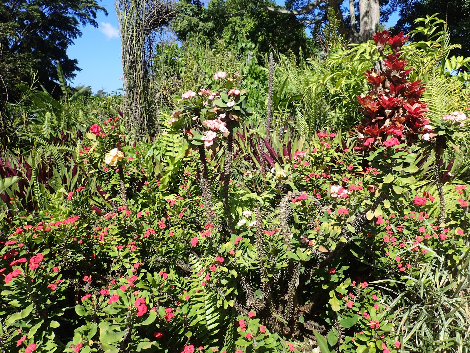
| Peter satisfied my gardeners spirit by patiently following on rambling paths and taking some shots. It took more than two hours to get through the extensive grounds. |
 |
| We often wander through cemeteries on our hikes. The variety of style always amazes us. This one was unique. Some graves were only marked with conch shells while the tombs were all above ground. Those for females were decorated with pink tiles and those for males in blue. |
 |
| Milly juxtaposed. |
 |
| Another hike took us to this undeveloped beach. From there we decided to try a long, steep and rocky ascent over Grande Morne, a very high promontory, back to Milly...in flip flops. |
 |
| Enjoying an early morning cruise and cup of tea. |
 |
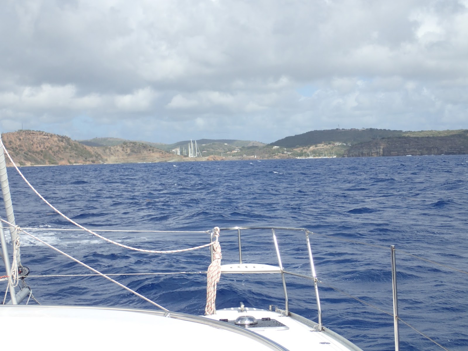
| Hello, English Harbour, Antigua! |


No comments:
Post a Comment