22 April 2022

San Blas: The Guna

Within minutes of arriving at our first San Blas anchorage, we watched these hardworking fishermen in their dugout ulu

Our first expedition from Shelter Bay Marina in Panama was to a bucket list destination for many cruisers, the San Blas Islands also called the Guna Yala Region.  The Guna are one of eight officially recognized indigenous groups and the most high-profile.  Panama won independence from Columbia in 1903 and the Guna territory that had been relatively independent previously came under restrictions imposed by the new government.  In 1925 the Guna rebelled against the Panamanian government  to protest the forced suppression of traditional daily life and lack of recognition of their culture - women were not allowed to wear traditional dress, missionaries and colonial schooling was forced in their communities.  A settlement was finally reached in 1938 as the Guna accepted Panamanian sovereignty in exchange for clearly bounded territory and a high degree of autonomy.  Today it is clear that the Guna continue to live a traditional life while adapting to limited tourism.  Marriage outside the Guna is not allowed and if done, the couple must leave Guna Yala.
Fruit and veg boats made the rounds with the obvious and other necessities - toilet paper, gasoline, beer, wine, water etc.  Some boaters stay for months surviving on these floating shops with maybe a few special delivery requests.

These guys happily raised their sails to show us their prowess.  And Milly made the perfect backdrop.

Paddling and wind power in a streamlined craft means that they could efficiently go about their fishing business, island to island.  So fun to watch and marvel at.  We didn't see anyone dump in these boats that were a tree trunk wide.

Most islands were uninhabited but several had family homes such as these.  Some had just a hut made of palm fronds for fishermen's shelter overnight. All were simple and made of whatever was around, mainly renewable, fast-growing materials..

We visited Nargana-Yandup, an island town, just off the mainland with our sister-ship, Mira.  Two islands connected by a bridge were packed with forlorn looking concrete buildings.  Unlike the islands, the villages are neither pristine nor beautiful.  Only the occasional palm squeezed through the chock-a-block tin rooftops.  Instead of sandy beaches, the coast is lined with boat launches and overhanging outhouses.  In this particular town, the residents had chosen to give up much of the traditional Guna culture.  We were curious to visit, reprovision and buy some gas for TomTom but there was an outbreak of Covid.  A "sentry" greeted us at the dinghy dock but refused to allow us to explore any further.  We were able to buy some gas, though, from the gerry can of one of the dockside residents.


Meet Venancio.  The youngest son of many in his family, he was taught to make molas by his grandmother.  I had been told by several other boat friends to expect a visit from him and that he made the best molas.  Sure enough within hours of our arrival at Chichime, our first anchorage, he appeared with his charming smile.

The production of molas, or the decoration on female blouses, are the main activity of Guna women, and is for many families the principal source of income.  It is a hand-made textile that forms part of the traditional women's clothing along with a patterned wrapped skirt often green and black, a red and yellow headscarf, arm and leg beaded cuffs, a gold nose ring  and earrings.  Molas are made by Guna women and omeggid - 'third gender' males.


Venancio brought his garbage pail and bags full of molas onto the boat.  He pulled out each one, slowly waving it in front of him to show it off.  If my ohhs and ahhs were of the right tenor - he is an expert - he decorated our cockpit with it.  By the end, there were at least thirty to choose from.  I was flummoxed but managed to narrow it down to eight from my intended five.

The mola originated with the tradition of Guna women painting their bodies with geometric designs, using available natural colors; when colonized and introduced to Catholicism, the naked female torso was no longer acceptable and these same designs were woven in cotton.  Traditionally, the mola is worn as a decorative panel on the front and bay of the woman's blouse.

Brightly coloured layers of cloth with shapes cut out to reveal the colour below, edges overturned and painstakingly and very finely stitched, then embellished and embossed.   

The top layer in this one is the purple with black underneath and then pink.  The purple is cut to outline the plant in black.  It's so intricate, it's tough to figure out what's what.  The stitches are so tiny, they are very barely visible.

This one chosen especially for our soon-to-be born grandson.  Sailing indoctrination begins early.

Another adventure with Mira's crew.  A tour lead by Mola Lisa, a transexual mola maker - I bought another two from her.  She and her chauffeur picked us up from Milly and Mira in her souped up ulu.  Nothing glamorous and still only a tree trunk wide meaning we sat single file but with higher sides and fibreglassed.  Our destination was a river on the mainland.

We crossed the sandbar at the river entrance and then our assistant guide poled us up river.  Lisa promised that there were no crocodiles in this particular river as we jumped out to ground the boat while we hiked.

Our first and most interesting stop, the burial site of Lisa's parents and siblings.  Lisa chatted to them, paying special attention to her mother.  On each she placed a bowl of cocoa beans to burn as incense.   

Each family grave site is covered with a thatched or, for those who can afford, a tin roof - Lisa 's goal was to cover her site with tin - to protect the graves from the rain. 

The body is laid to rest in a hammock a buried so that a mound of packed earth - looks like clay - is oriented toward the rising sun.  The graves a decorated with flowers and every day tools symbolic of the dead.


This was a very special place unlike any other burial site we have seen in our travels.  We felt very lucky.

And then to the silly...Lisa harvested three blossoms she called "Marilyn Monroe Lips" - I have no idea what they are really called.  We posed on cue.

Finally, after a long hike through the jungle and small plots of land where hopeful farmers were struggling to tame the lush natural plants, we reached a waterfall where we took a quick and welcome plunge.

Harvested along the way, our assistant guide was carrying bananas back to the village to share with the families.


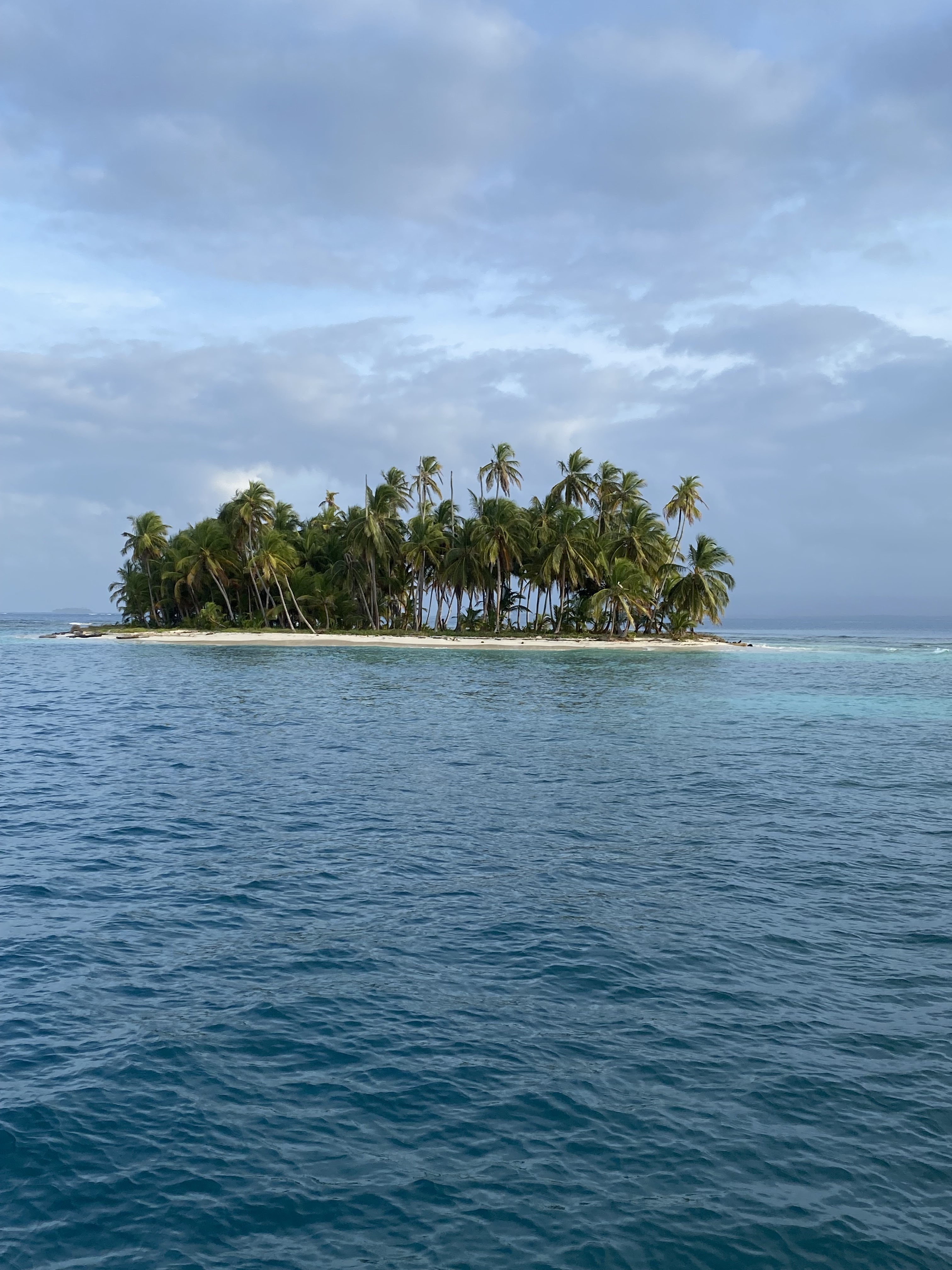
The Guna Yala Region has an area of 2.306 square kilometres (0.89 sq mi). It consists of a narrow strip of land of 373-kilometre (232 mi) long on the east coast of Caribbean Panama, bordering Colombia and an archipelago of 365 islands along the coast, of which 50 are inhabited.  And this one has a couple of buildings and a couple of palms.


They are the quintessential tropical island - deserted, topped with coconut palms, bordered by white sand beaches or mangroves, clear turquoise water and coral reefs.


Milly, looking pretty.


Strangely a little herb garden on an otherwise uninhabited island.


Cruisers are warned not to pick any coconuts which are described as Guna currency.  This coconut  is sprouting.

There wasn't as much fish life as we anticipated, although the coral was alive, varied and abundant.  This starfish, one of many, in the incredibly clear water.


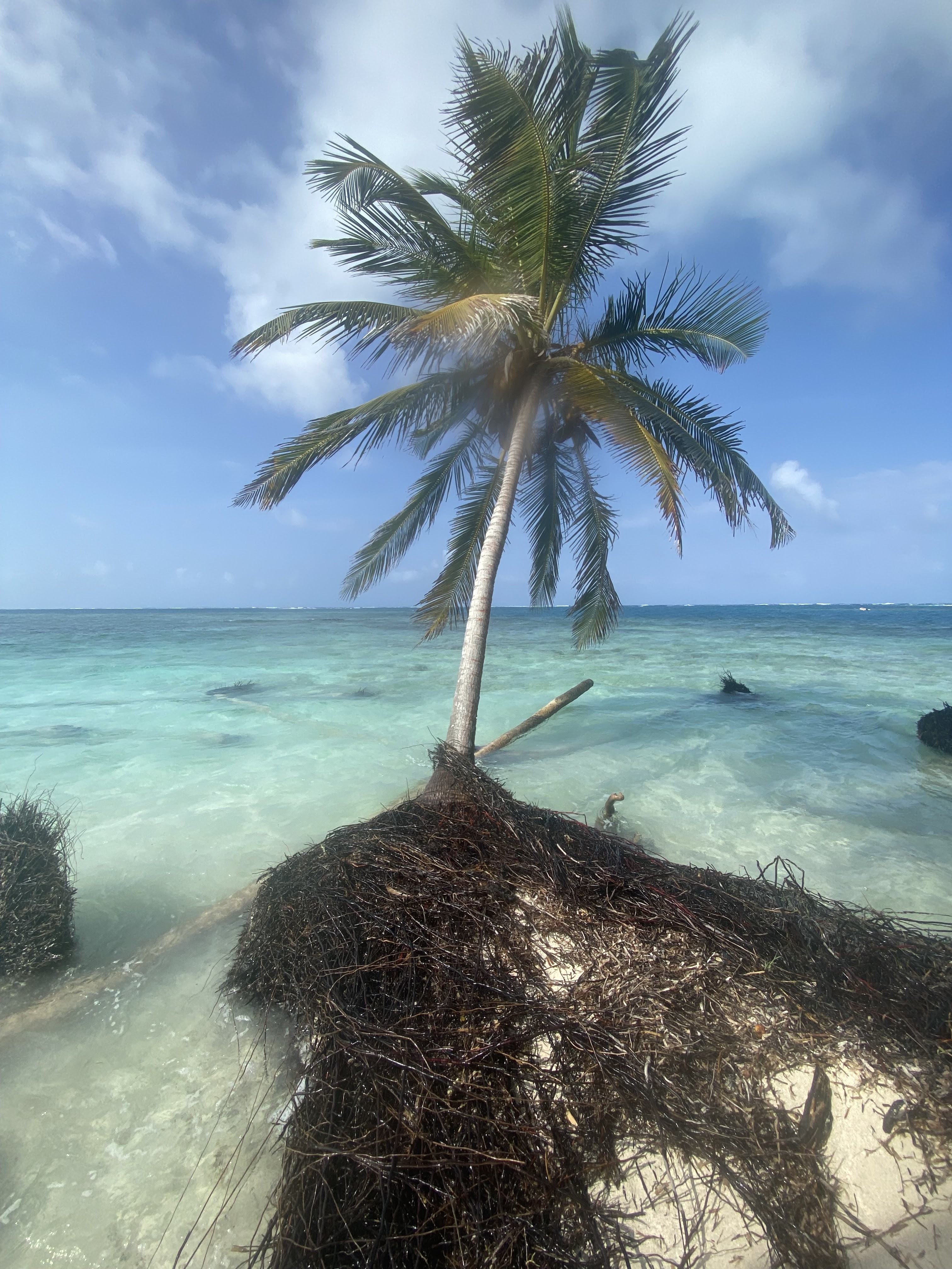
Very sadly, these islands are flat and barely above sea level.  They are already suffering from the effects of global warming.  Trees on almost every island are flooded and dying.  The shoreline's mass of roots are eroding from pounding waves that are now more commonly crashing over the reefs.

Families who used to live on the islands are choosing to move to the mainland or the town islands.  We happened to be visiting during the school vacation/dry season when the Guna return to the family's islands for the hols.  Tragically, it is increasingly likely that many of these islands will be permanently submerged in the not too distant future.


Our Mira mates, on a dinghy river explore.  So fun to spend some days with them.  We're hoping to do it again.


Milly and Mira, sister ships.


It was hot!!  Inspired by Mira, Peter contrived a sun shade for the bow out of one of Tom's laser sails.  Excellent!

We had a great, if abbreviated time, exploring Guna Yala.  It was time to go back to Shelter Bay where we would leave Milly for a trip home to meet our new grandchild!!

25 March 2022

Intro to Panama

On our first walk from Shelter Bay Marina, an easy 10-minute amble into the jungle, we were so excited to see baby and mum, or maybe dad, capuchin above us.  I knew I was going to love it in Panama!

We arrived in Shelter Bay Marina in early January, entering the canal breakwater among a hundred or so anchored cargo ships and tankers.  The marina dock staff met us with enthusiasm ushering us into a slip, tying us up with alacrity - the very best we have experienced in our limited marina stays.  And then friends, Michelle and Glenn, from Rosie Skye, cruisers we had hiked, ate and drank with in Carriacou, welcomed us with hugs.  So great to reconnect.  And it happens more often than one would expect - the "coconut run" along the trade winds, east to west, is, by far, the most common route for circumnavigation.

Our first major hike led by Peter with four others took us down a steep cliff and through a mangrove swamp.  I went on all fours, root to root, before taking the much more elegant method as Michelle was demonstrating, plodding through the sucking mud.  Glenn, an Aussie who should know, told us that it was perfect croc territory - that was when we were in the middle.

Lo and behold, Glenn was right.  This croc is a regular on the river the mangrove we had slurped through ends at.  We spied him/her from the safety of a bridge traversing the river.  He slipped off the bank while we watched, into the river after a foolish but lucky bird.  Her speed (the croc's) made it very clear that a human who wandered too close would not have a chance.

Panama made an immediate positive impression.  The marina is situated on an old American army base, Fort Sherman, now overgrown in thick jungle.  An initial wander along the deserted roads and lanes into the base led us to a deserted church with simple frescoes, batteries abandoned to bats, and cages for the exotic animal specimens they found.  The fort was built in conjunction with the construction of the canal.  A brother fort on the Pacific side protected both of the canal entrances.  It was also used for jungle warfare training - perfect place for it, the jungle has now taken it over.  In 1999, it was turned over to the Panama government who use part of it currently for their own military training - we hear the hollering of troops on double time runs in full gear and in formation regularly.  Apparently, they catch a lot of drug running vessels in the bay and escort them to Panama City.  
We usually see howler monkeys in large extended family troops.  They watch us as curiously as we watch them, often coming directly over us in the branches.  A marina nature guide told us, as he leapt away, that the males aim a steady stream of urine at human below.  An effective way of marking his territory.  The howls, aptly named, from these small monkeys are very loud.  It's easy to believe that on the mountain slopes they can be heard from kilometres away.  They open there seemingly little mouth very wide and emit an enormous howl regularly, another way of marking territory, communicating, or being macho?  


A beautiful golden silk spider at the edge of our hiking path, laying eggs as we watched.

Milly in Shelter Bay Marina on the edge of the jungle.  Our later neighbour saw a croc one day on the water's edge - another reason, among many, not to swim in this, or any, marina.

On a much more interesting note for us, the jungle here is full of wildlife.  Even on our short walks we regularly see white-faced capuchin monkeys and troops of howler monkeys, agoutis and coatis, parrots and toucans and vultures.  Even a crocodile.  And apparently there are many, many more from frogs to birds.  Our untrained eyes overlook a jungle teeming with life.  It's an amazing place, all within a 5 minute walk of Milly.  We hear howler monkeys regularly during the day, especially before rain, at dawn and dusk.

Panama is also chock-a-block full of history.  Apart from the recent 20th century story of the building of the canal - more about that when we actually cross it - the north coast is full of conquistadors, pirates and privateers with gold, forts and, unfortunately, razed towns.  It's a brutal history, all about greed, but in the locations we visited, because they are so undeveloped, it was easy to imagine the hustle and bustle of the 17th and 18th centuries.


Portobello, said to have been named by Christopher Columbus when he spied a beautiful protected bay on an otherwise exposed coast often hit by large swell.  During the Spanish colonial period, Portobello was the most important port on the Caribbean side of Panama.  It was the end point of the mule train from Panama City on the Pacific coast, carrying the plunder of gold and riches from South America.  The customs house, now closed for renovations, is the biggest building in town and held troops to guard the treasures inside.  Fuerte San Jeronimo, is one of three forts guarding the town.  Over the 200 years of the town's heyday, they were attacked multiple times by pirates/privateers including Francis Drake, whose coffin lies at the end of the bay, and Henry Morgan.

The bay is indeed bello.  Hills and mountains covered with green and the occasional crop field etched into the jungle.  Only 400 years ago, it was teeming with ships and activity.  Now, there are a handful of sailboats anchored, several abandoned.  The stone from the forts were used to build the canal by the French and are now largely ignored by the residents who kick soccer balls against the walls.  Time of prosperity has definitely vanished.

The town of Portobello is impoverished today.  Although the church, closed when we visited, houses a celebrated Christo Negro, tourists often don't venture this far east.  The surrounding land is lovely, the bay is beautiful and the nearby beaches are gorgeous and water access only.  Perhaps Portobello will enjoy a revival - at least enough to support the population.


After our first explore, I knew that Panama was going to be among our favourite countries.


9 March 2022

Passage to Panama

Our route from Bonaire to Panama.  To avoid the rougher waters off the coast of Columbia, we did an indirect arc up and over.  It worked to some degree. 


The passage from the ABC's to Panama is referred to by some circumnavigators as among the top five most difficult passages.  There is an almost constant pocket of high wind off the Columbian coast which brings big waves and swell often from different directions.  The trade winds funnel around the La Guajira peninsula.  And then katabatibc winds off the Sierra Nevada range contribute fierce katabatic gusts.  Instead of leaving for Panama in early to mid December, before the northeast Christmas winds exacerbate the trades, we so enjoyed our time in Bonaire that we delayed our departure until after the New Year when the seasonal winds were well entrenched.  

After studying the weather charts, we decided to leave on the five day (and night) passage on Tuesday.  Due to technical difficulties, we were unable to use our satellite system to upload weather info while on passage.  Peter took multiple screen shots of weather for the five passage days.  And our dear friend, Anne, assisted by husband, Rob, in Canada volunteered as weather router, texting us at least daily with updated info re the red blob - location, size, wind strength, wave direction etc.  We couldn't do much about it but at least we knew what to anticipate.  Along with the weather forecasts, talking with other cruisers who had done the trip gave us the local wisdom - don't do the tempting rhumb line from the north end of La Guajira Peninsula to our destination, Shelter Bay Marina at the northern mouth of the Panama Canal.  Instead, sail northwest from Bonaire, then west, not turning southwest until beyond the red (high wind) blob.  At all times, at least 100 NM off the coast of Columbia.

We left Bonaire with three other boats on January 4th. We had all had lunch together the day before to say good bye, one of the difficult things about cruising.  We had spent Christmas, New Years, hikes and dives with the German and Swiss crew and we were sad to part ways.  All three were headed to Dominican Republic.  We were going west.

Leaving Bonaire, we headed northwest with the waves and swell on our beam.  Big and choppy. My worst point of sail for seasickness but I had taken Bonine - my treatment for seasickness along with chewy ginger candies - and I was grateful to be fine.  No reading but otherwise happy.


Day of departure: The white dot is approximately at our second waypoint and as far north as we thought we would go.  The white streaks are the wind direction, on our stern one we turned due west - very nice.

You notice that the wind direction curls around to come from the north which, thankfully, made almost our entire passage downwind.

Sunday's forecast on the previous Tuesday before leaving Bonaire.   We thought/hoped we would be in the green almost at the canal before Sunday when the blob got more widespread.  Unfortunately, by Saturday when we thought we would emerge out of the red and into green, Anne told us it was red to the Panama coast.  No problem really but demonstrates that this five day old forecast was inaccurate.  We were glad to have Anne watching for us.

Downwind sailing, even in big waves, is quite comfortable.  The boat surfs down the swell, riding the waves with ease.  And these swell were BIG - higher than the arch on the stern.  We estimated three to four meters high.  More importantly, they were steep.  Instead of a long, gentle swell with a period of 10-12 seconds, these were about 6 seconds.  We didn't get pooped - sailing lingo for a wave/swell breaking over the stern of the boat - but we were thoroughly soaked with splashes on the port quarter (back of the boat, port side).  By the third day, we couldn't sit in the cockpit except at the helm, which was high and almost dry.  I had made lots of frozen meals but even heating them up on the stove was not enticing.  Still, we were relatively comfortable and marvelled at the waves after two years off the sea.

The end of my final watch at dawn, brought the ships only visible on our chart plotter at night, into view.  You can see eleven in this shot.  


The little triangular icons are other ships on our AIS, a system which is a godsend, especially at night. At this point there were 250 targets/vessels on the AIS system.  It tells you how fast a vessel is going, it's direction and in how many minutes the closest point of contact/collision with Milly will be.  It always amazes me how often in the wide open sea, we are on a collision course!  The black icon is Milly.  The black line on her stern is the route we have travelled.  The blue vector off her bow is the direction the boat is steering while the red vector is the actual direction we are going with current and swell taken into account.  Each vector ends at where Milly will be in 10 minutes.  The other ships have black dashed lines on their bows showing us their direction, speed (by the length of the vector) and where they will be in 10 minutes.  These enormous 300 m ships move fast!! The dots in the centre of most of the ships indicates that they are anchored - we can go as close to them as we want but you never know when they will begin to move.  The blue x at Milly's stern is our last waypoint we had entered on the chart to put us at the opening in the Panama breakwater directly south of us.  

The final challenge that made this passage interesting was the number of ships we encountered in the final two nights.  Once we turned southwest, we realized that our route was also the same path that these humungous cargo and tanker ships were taking to go to the Caribbean, US east coast, Europe, The Suez, the northeast coast of South America, etc. etc.  To further complicate things, there were the occasional ships that came toward our port beam from Columbia.  

Peter sleeps well on passage because he knows I am extremely (maybe, too) diligent in my goal to avoid ships by at least 2 NM at night.  I would move to the right or the left to avoid ships coming up our stern to pass or coming toward us along the same line.  That was relatively easy although our path jogged a couple of miles to the left or right through my watch.  

On the last night, I felt like a tiny mouse chased by a huge cat that was coming toward us from Columbia.  Although downwind is comfortable, it is limited by gybing if required to go past 180 degrees.  I can manage a controlled gybe on my own but really prefer not to.  It's also impossible to tell whether the ship will pass in front of us (better) or behind us (unnerving since it means we have to squeak by in front of it) until it is quite close and under, say, 20 minutes away.  So it was hard to tell whether I should slow down - at the wind's discretion when downwind, speed up with the motor or head up making us go faster and change direction by a few degrees.  So this huge ship called, Ocean Mystery, bound for the canal, kept me on the edge of my helm seat for my last watch.  Happy ending though.  It passed in front of us less than 1NM distant as the dawn broke.

As we approached the canal, we followed the radio chatter of the Cristobal port officer - very efficient woman - giving direction to the many ships, telling them where to anchor, when to pick up anchor, when to head to the breakwater entrance, where to go once in Limon Bay, how to pick up a pilot etc.  It was fascinating entertainment.  She didn't want to hear from us until we were 1NM away and told us just to keep on going through and to the marina, situated inside the breakwater.  

We entered Shelter Bay Marina, were directed to our slip, assisted by very friendly and efficient dock staff and welcomed by our friends from Carriacou who happened to be there.  After cleaning the salt off Milly's inside and outside and off ourselves we were ready and excited to explore Panama.